Every elevation
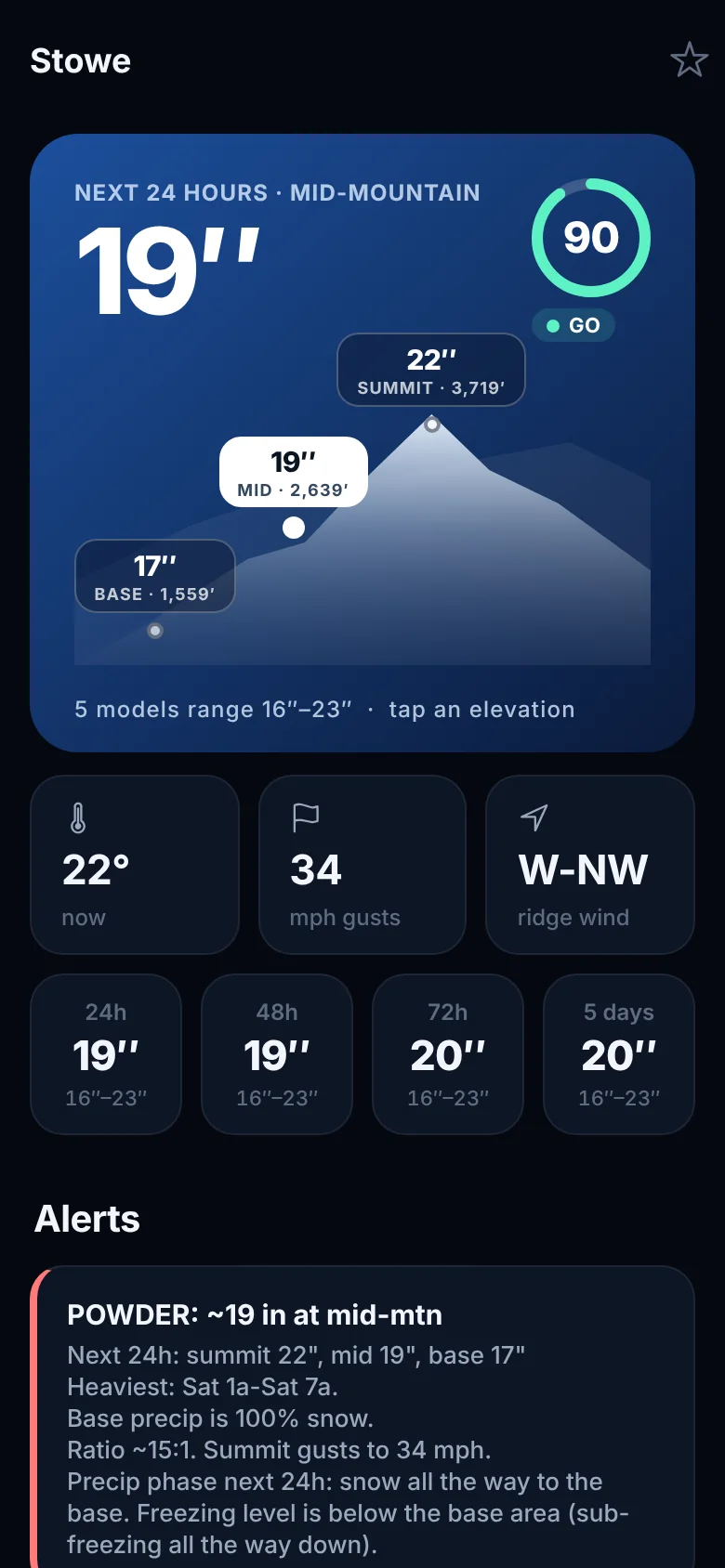
Rain at the base. A foot up top.
A mountain isn’t one place, so one number for “the resort” is often wrong. Powhunt forecasts the base, mid-mountain and summit separately, and works out snow versus rain, and how light it’ll be, at each one.
- Where the rain turns to snow, called out in plain English.
- Icy mornings, freezing rain and wind holds flagged before they wreck your day.
Storm map
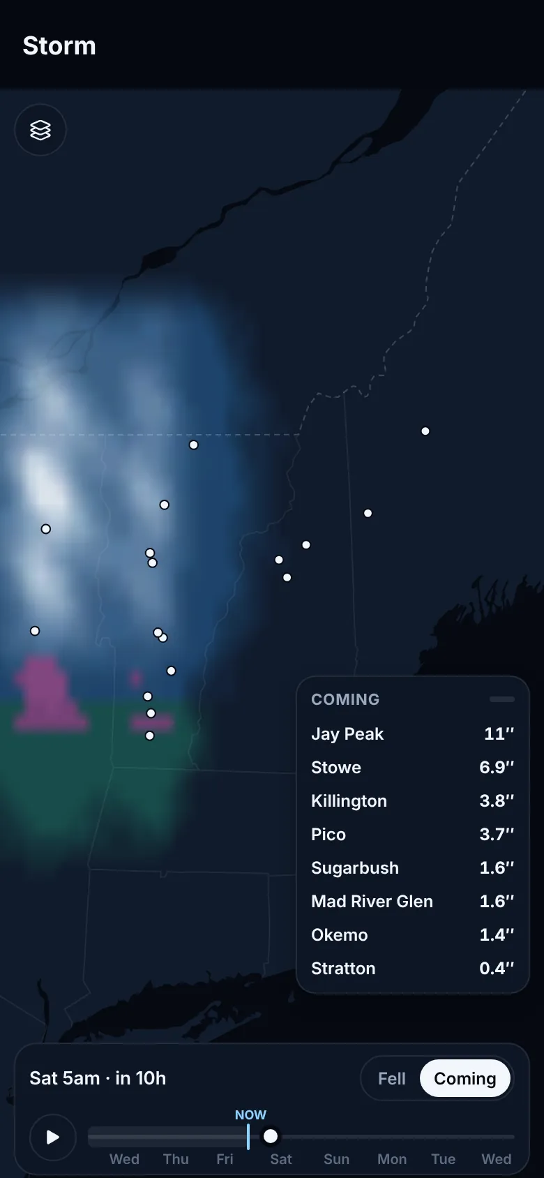
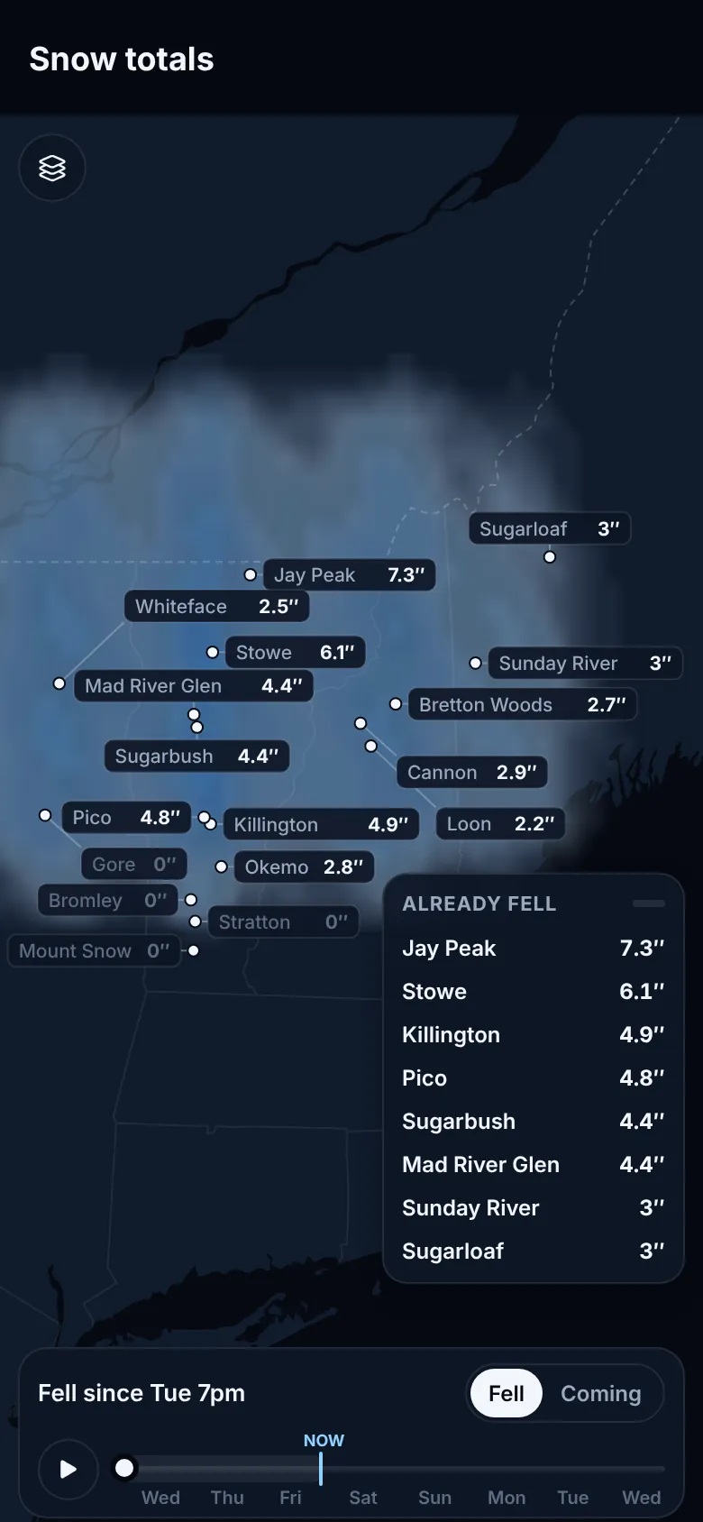
Watch the storm roll in, hour by hour.
Drag through five days and watch snow, rain and mix move across the Northeast and Quebec, drawn by our storm model over the real terrain. Slide back to see what already fell. A floating list re-sorts every mountain as you go, with yours on top.
- Coming or already fell. Three days back, five ahead, on one timeline.
- Snow totals for every mountain on the map, for the base, mid-mountain or summit.
- Where we’d go this weekend, with a backup, right on the home screen.
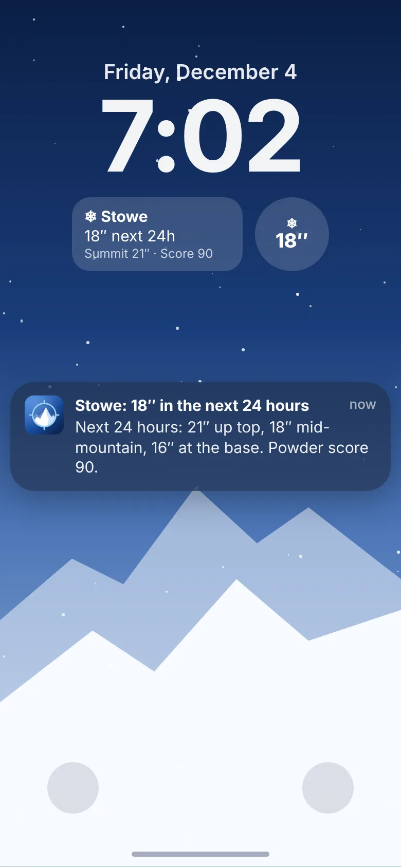
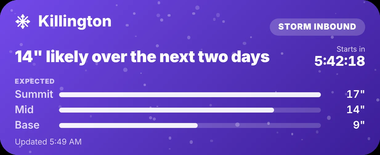
The storm card: on your lock screen when a storm is inbound, updated as it falls, gone when it’s over.
Written for skiers and riders
A forecast that reads like a friend wrote it.
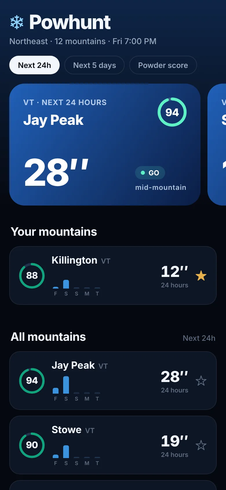
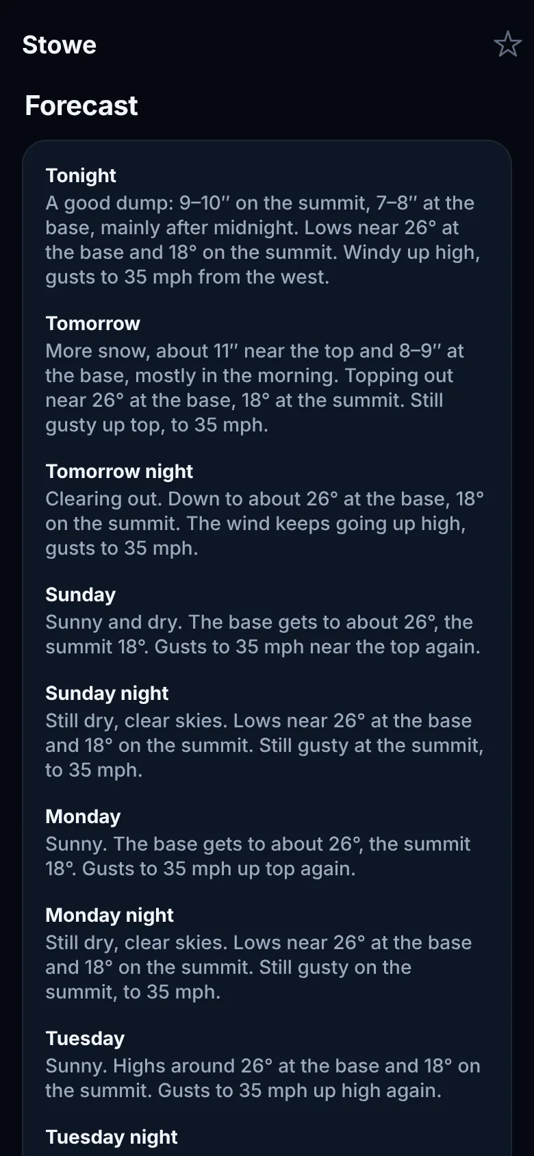
Every mountain gets a plain-English forecast, day and night, for the base and the summit. And when your mountain is about to get real snow, your phone tells you.
- Powder alerts for the mountains you star, only when it’s worth it. Tap one and you land right on that mountain.
- Home and lock screen widgets with the next 24 hours at your mountain, updated through the day.
- Storm cards on the lock screen and in the Dynamic Island while a storm is inbound or falling: summit, mid and base totals, live until it’s over.
Ride with your crew
One call for the whole crew.
No more group chat arguing over where to go. Share the weekend pick with your friends and everyone gets the same call, the same backup and the same heads-up the moment the snow shifts.
Start a crew in one tap
Hit share under the weekend pick and send the link. Your friends are in seconds later. No accounts, no sign-ups.
In, maybe or out
Everyone sees the pick, the backup and who's coming. Lock in the carpool before the lift line forms.
One alert when the call changes
Storm jumps north? The whole crew hears about it at once, so nobody drives to the wrong mountain.
The Powhunt engine
The sharpest snow forecast in the Northeast.
Built for the days that matter. Our proprietary storm model calls each storm for the base, the mid-mountain and the summit of your mountain, so you know where the deep stuff is and you're on the first chair when it lands.
Beats the major models on snow
Head to head with the best forecast models in the world, Powhunt calls the next day's snow closer. Two winters running.
Closer on temperature
Cold smoke or mashed potatoes? Know before you leave the driveway. Closer than the big models at every range from 1 to 5 days.
Base, mid and summit
The parking lot and the summit get two different storms. Powhunt calls both, so you know where the best snow is before you gear up.
Built for chasing storms
Everything you check before 6 a.m., in one place.
No more flipping between five weather sites and a resort report at dawn.
Powder score
One simple score for every mountain that weighs how much is falling, how good it’ll be, how sure we are, and whether the lifts will spin.
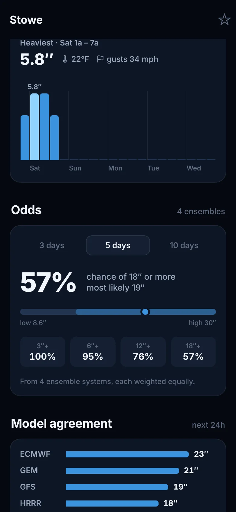
Odds, not guesses
See the real odds of 6, 12 or 18 inches in the days ahead, and how confident the forecast is, instead of one number you can’t trust.
Timed to the storm
See when the heaviest snow arrives, with temperature and wind, so you know whether to call in sick on Thursday or Friday.
Graded every day
Every morning the Powhunt engine is graded against what actually happened: weather stations on and near the mountains, snow observers and the resorts’ own reports.
Starting in the Northeast
Northeast first. Then the world.
We’re launching in Vermont, New Hampshire, Maine, the Adirondacks and Quebec, then rolling out to ski areas worldwide. Pick your home mountain when you join: it helps decide where we go next.
Be first on the mountain.
Join the waitlist for early access when Powhunt launches this winter.